
KNOXVILLE — Meteorologists at the National Weather Service regional office at Morristown on Thursday (Sept. 26) evening described approaching Hurricane Helene as an “historic setup for the Southern Appalachians that we haven’t seen in decades.”
The hurricane itself, which at about 11 p.m. made landfall on the rural Big Bend of Florida, is already breaking storm-surge and other records. It will have a widespread impact in coming hours and days well inland, traveling north across Georgia into the Tennessee Valley and along the spines and crests of the Southern Appalachians. It is projected to drop prodigious amounts of rain, especially across Western North Carolina, which was under a tropical storm warning at 11 p.m. Tropical storm conditions are possible in Knoxville as the remains of the storm head into the region, according to the weather service.
Helene is already affecting transportation, public works, commerce and personal lives and Hellbender Press will be here to provide as many updates as we can throughout the storm, aggregated from multiple sources. We are focusing on the breadth and depth of the storm as reported largely by citizen scientists and those who share their expertise via social media and use of open-source applications.
Update 9:30 p.m. Sept. 27
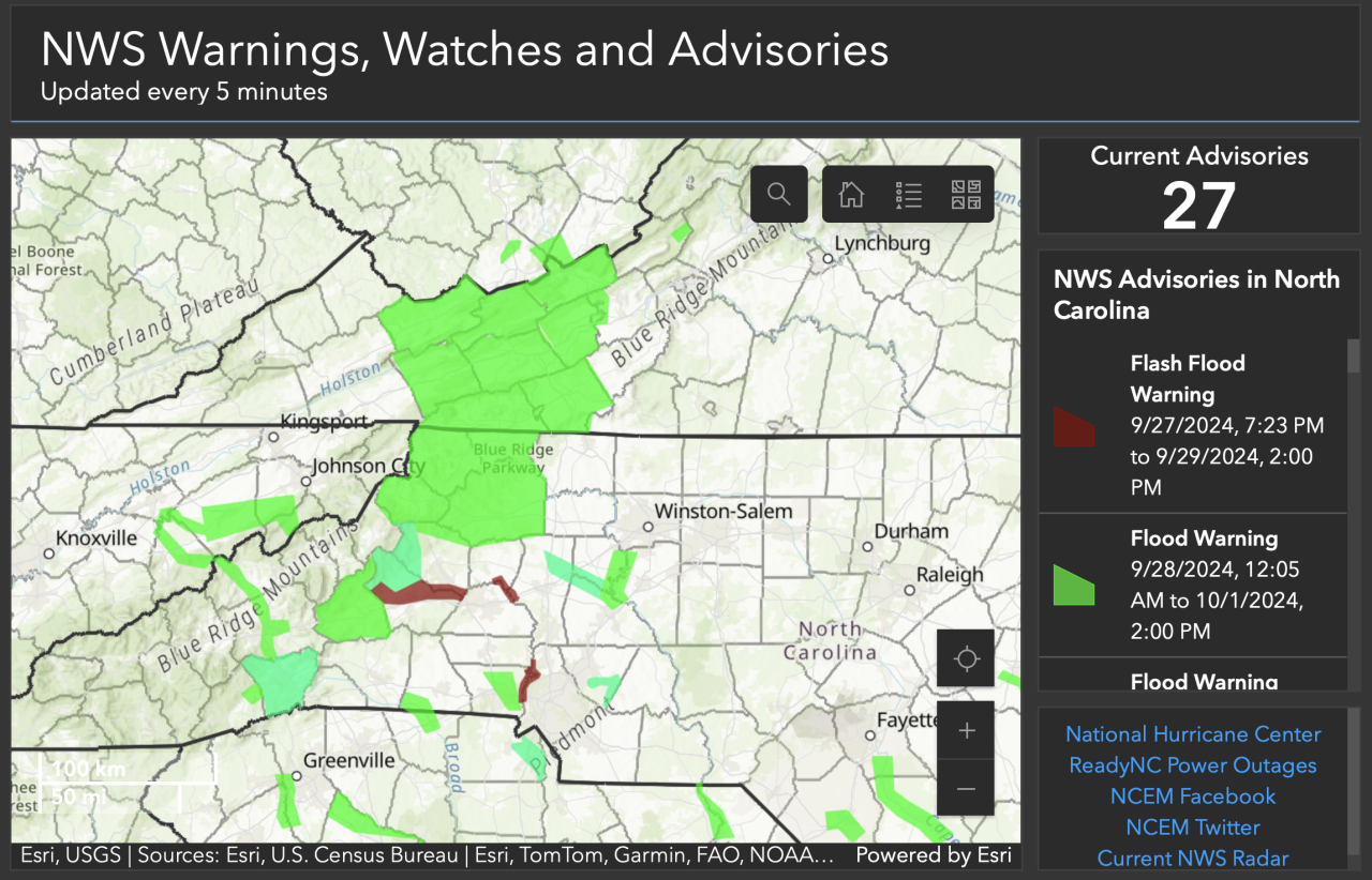 Touch the map to see present alerts.
- Multiple sources report that USA Raft Adventure Resort along the Nolichucky River was destroyed after the river reached unprecedented levels on Friday:
“USA Raft is gone gone,” Katie Prince told Hellbender Press via social media. “The Bridge at Johnny’s is gone. Big Rock is about 30’ underwater. Houses, cars, large propane tanks floating down the river. Gauge blew out at 92,500 [cubic foot per second]; speculation is it reached 150,000 today.”
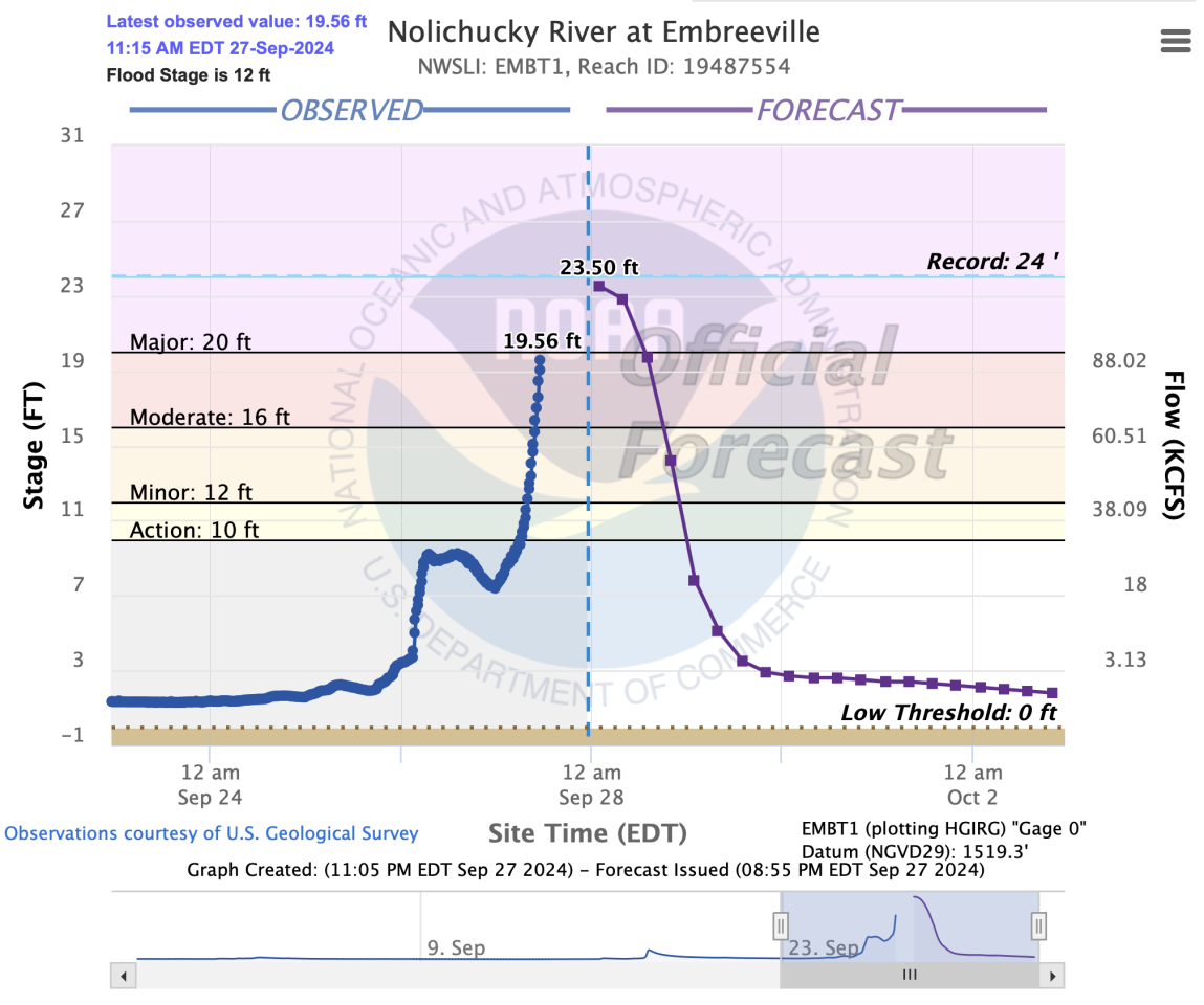 Nolichucky River gauge at Embreeville stopped recording at 11:30 a.m. To accurately determine how hight the water level rose will require on-site expert investigation. The all-time record for this location is 24 ft on May 21, 1901. 2nd highest is 21.52 ft, Nov. 6, 1977. However both historic numbers predate the current gauge and are associated with some degrees of uncertainty.
- Mobile homes floating down the Nolichucky River near Roan Mountain. Video provided by Amber Harkleroad Waycaster. She was evacuated shortly afterward. “This is our backyard. Water has a ways to get to us still, but pray guys! We’ve seen water rescue and homes destroyed.”
- Pigeon River at Hartford also flooded rafting outfitters. When the numbers are added up, it could be a dark day for the regional recreational whitewater industry.
- Jon Mitchell of Johnson City said he lost two RVs to the Nolichucky; they were parked near the now-evacuated Unicoi Hospital. He said the level of damage is astonishing. He created a new verb: The area, he said, had been “FEMAd.”
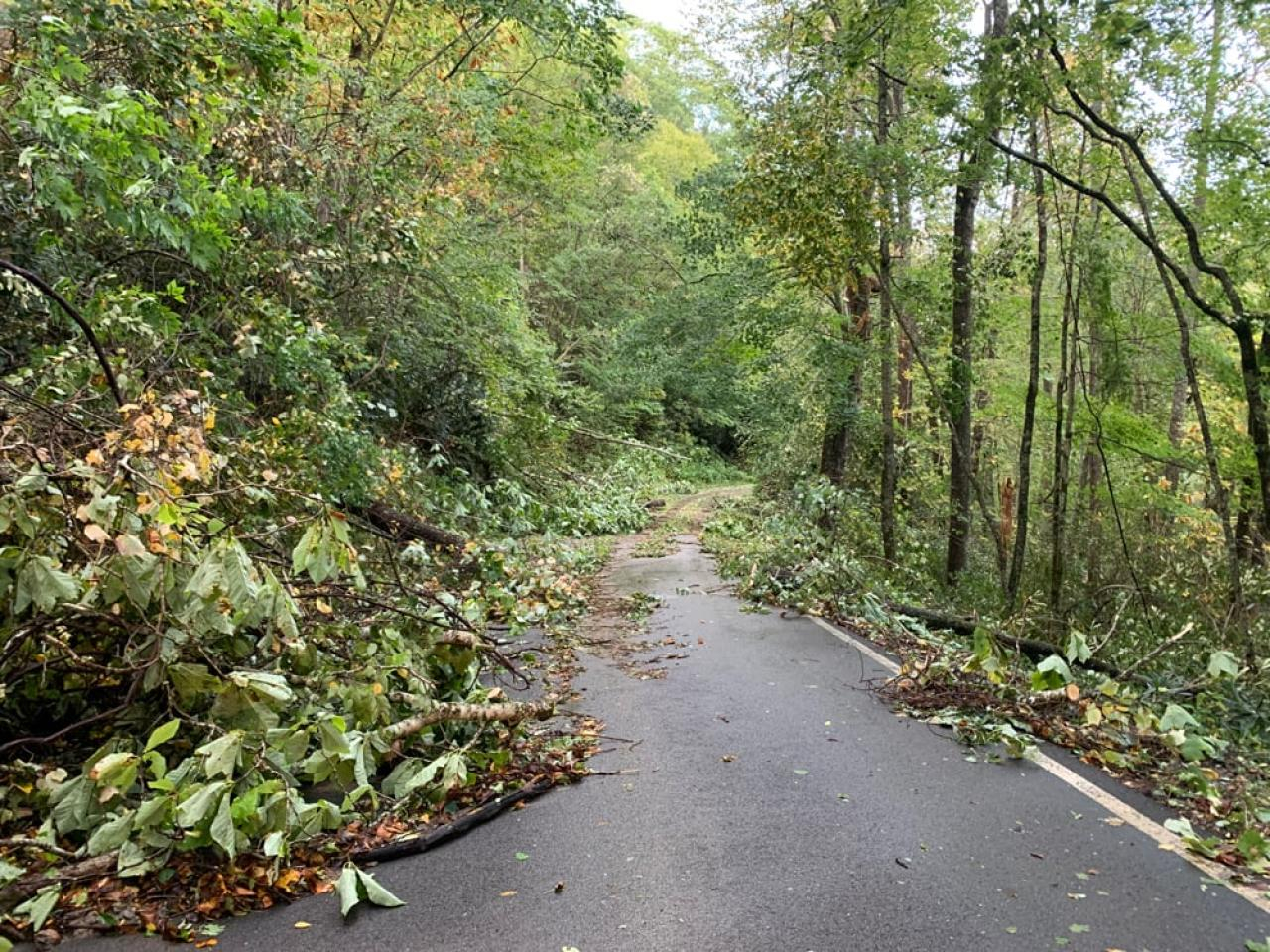 Residents of Ripshin Ridge near Roan Mountain had to chainsaw their way to main roads. Buzz Trexler
Update 7 p.m. Sept. 27
- Tennessee Emergency Management Agency released this update Friday afternoon:
“Unicoi County Hospital is inundated and patients and staff are being evacuated; however, the evacuations are complicated by the Nolichucky River, which is rapidly rising and full of debris. Local officials in Washington County have told Embreeville residents to evacuate. Hawkins County officials have told residents to shelter-in-place. Northeast Tennessee continues to be impacted by flooding. If you live in a flood prone area, please find higher ground, evacuate if you are told to, and stay informed of the evolving situation. Sheltering locations can be found on TEMA’s website. Many roadways have been impacted by flooding. Before going out, visit TDOT’s SmartWay website.” -
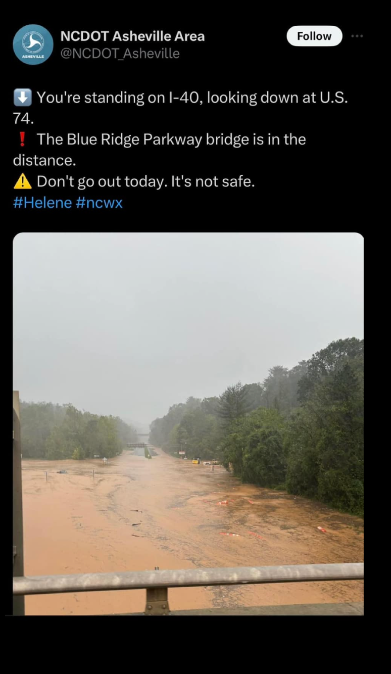
In addition to the landslide affecting Interstate 40 through the Pigeon River Gorge, I-26 is closed. Per NCDOT: “Catastrophic Transportation Impacts In Western NC
“I-40 and I-26 are impassable in multiple locations. All roads in Western North Carolina should be considered closed. Motorists should not travel in this area, should not attempt to drive through standing water, and must respect barricades and road closure signs.”
Update 6 p.m. Sept. 27
- There are reportedly massive floods under way in northeastern Tennessee, including Erwin and Elizabethton. The Tennessee Holler shared video of terrified animals amid extreme floodwaters, and indicated the National Guard may be activated. Patients evacuated Unicoi County hospital.
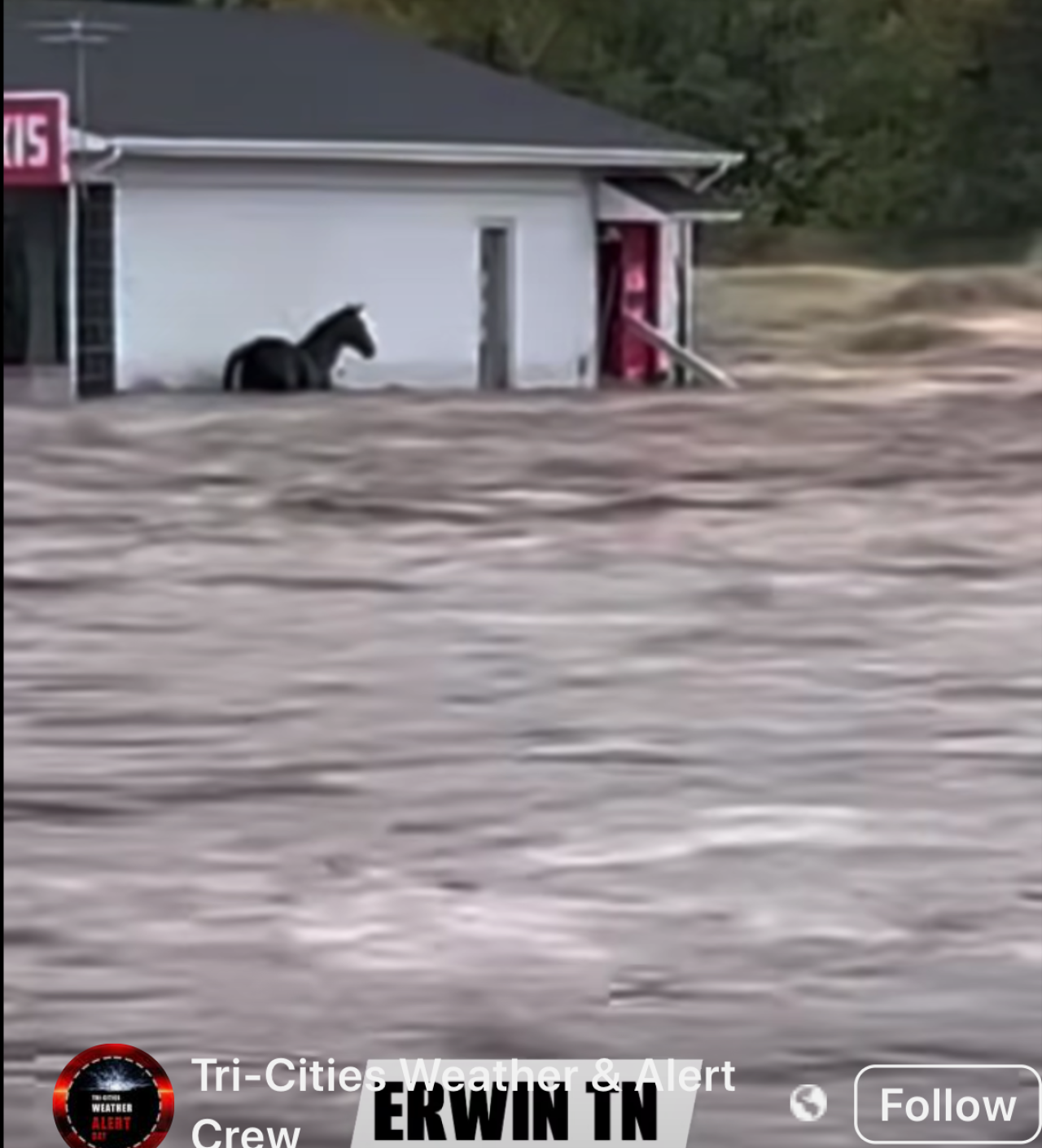 Touch the image to view the video.
Update: 5 p.m. Sept. 27
- Carolina Public Press: “Much of the worst damage in North Carolina has centered on Asheville in Buncombe County, the largest population center in western counties and a major convergence point for creeks and rivers.
- “There’s a lot of things underwater right now,” State Sen. Julie Mayfield, D-Buncombe, told Carolina Public Press. “They’re predicting this will be the worst flooding we’ve had in more than a century.”
- “What we are seeing is unlike anything anyone alive has ever seen here in this area,” Buncombe County Manager Avril Pender said at a Friday morning press conference.
- The Tennessee Valley Authority posted this on its X feed: “Tributary lake levels are rapidly rising, especially at Watauga, Douglas, South Holston, Fontana, and Cherokee. Expect high river flows below the dams as we maximize generation and supplement with sluicing and spilling to move this water through our system. Get real-time lake level info: tva.me/ll8o50TxfAb.”
- While most of North Georgia is recovering from Helene, Rabun County suffered major damage. A failure at Mathis Dam caused significant flooding in the south end of the county, and many roads remain blocked. The full extent of the destruction may not be known for days.
- The city of Asheville issued a boil-water advisory.
- Blogger Thunderpig has the latest on WNC power outages.
- The Smoky Mountain News reports that some of the worst flooding in WNC is in the Canton and Clyde areas of Haywood County along the Pigeon River.
- The CItizen TImes reports that Asheville police will enforce a citywide curfew beginning tonight.
Update 4 p.m. Sept. 27
- Helene is now a post-tropical depression centered over Kentucky.
- Chattahoochee Riverkeeper posted this on Facebook out of Georgia: “Parts of the Chattahoochee River Basin experienced major flooding as Hurricane Helene moved across the southeast today. The Chattahoochee River near CRK’s metro Atlanta office has risen by at least 25 feet since Tuesday. The storm has passed, but floodwaters continue rising in some areas. We hope everyone is staying safe and our hearts go out to all who have been impacted by the storm.”
 Chattahoochee River at 14th St Bridge in Columbus, Georgia. Chattahoochee Riverkeeper
 Flooding near Atlanta Memorial Park. Chattahoochee Riverkeeper
- Rutherford County emergency managers posted this on Facebook: “(N.C.) 9-27-24 at 1:30 PM: Water is cresting the Dam and flowing around the side walls. Structural supports have been compromised but the Dam wall is currently holding. Evacuations have occurred from the Dam to Island Creek Road. Evacuation sirens are sounding downstream of the Dam. Emergency personnel are working with the structural engineers and are going house to house to ensure all citizens have been evacuated. Evacuees are being transported temporarily to Ingles in Lake Lure. Text AlertRC to 888777 to get emergency updates.
- A rockslide has closed I-40 in both directions near the North Carolina-Tennessee line, according to multiple media reports. This could be one of the enduring legacies of this storm. The North Carolina Department of Transportation said “all roads in Western North Carolina should be considered closed.”
-
WBIR of Knoxville has a good report on the interstate closure in the Pigeon River Gorge.
Update: 2 p.m. Sept. 27
 Touch the map to interact with its latest updates. National Hurricane Center
Update: 12 p.m. Sept. 27
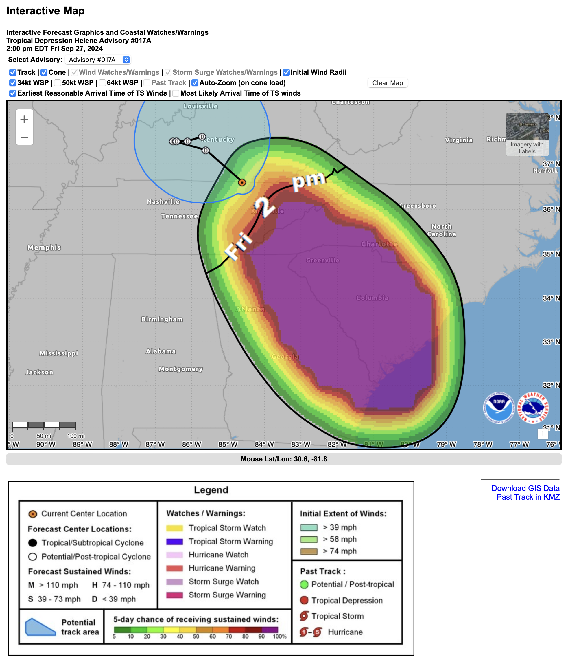
- Tropical Storm Helene is centered roughly over Murphy, N.C. in the Valley River basin. It is moving north and expected to degrade to a low and shift its track toward Kentucky. Tropical storm conditions are possible in the greater Knoxville area.
-
Winds are on the upswing in Knox County and rain is sheeting horizontally across streets already covered with woody debris. A high wind warning remains in effect for the Knoxville metro area and East Tennessee through 8 p.m. Expect wind gusts up to 45 mph. Power outages are a primary concern, as are the lingering effects of flooded roadways and steadily rising creeks, streams and rivers. Never try to drive through standing or running water, and keep an eye on children and pets near drainage areas and high, swift-moving water.
-
Nearly 3 million utility customers are without power in the affected Southeast states; outages are steadily mounting in East Tennessee.
-
Atlanta, like Tallahassee, was spared the worst predicted affects of Helene. Widespread flooding, downed trees, and blackouts mean expanded closures. All schools and many business are closed. Amtrak has canceled all trains, and many flights have been canceled or delayed.
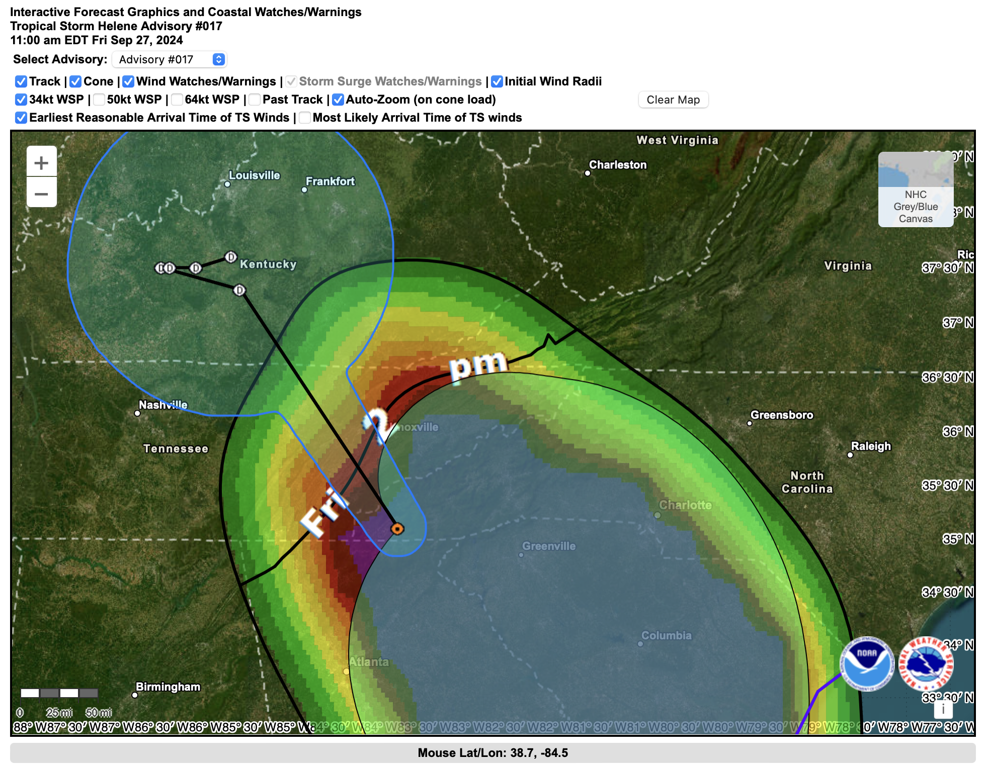
Update: 11:00 a.m. Sept. 27
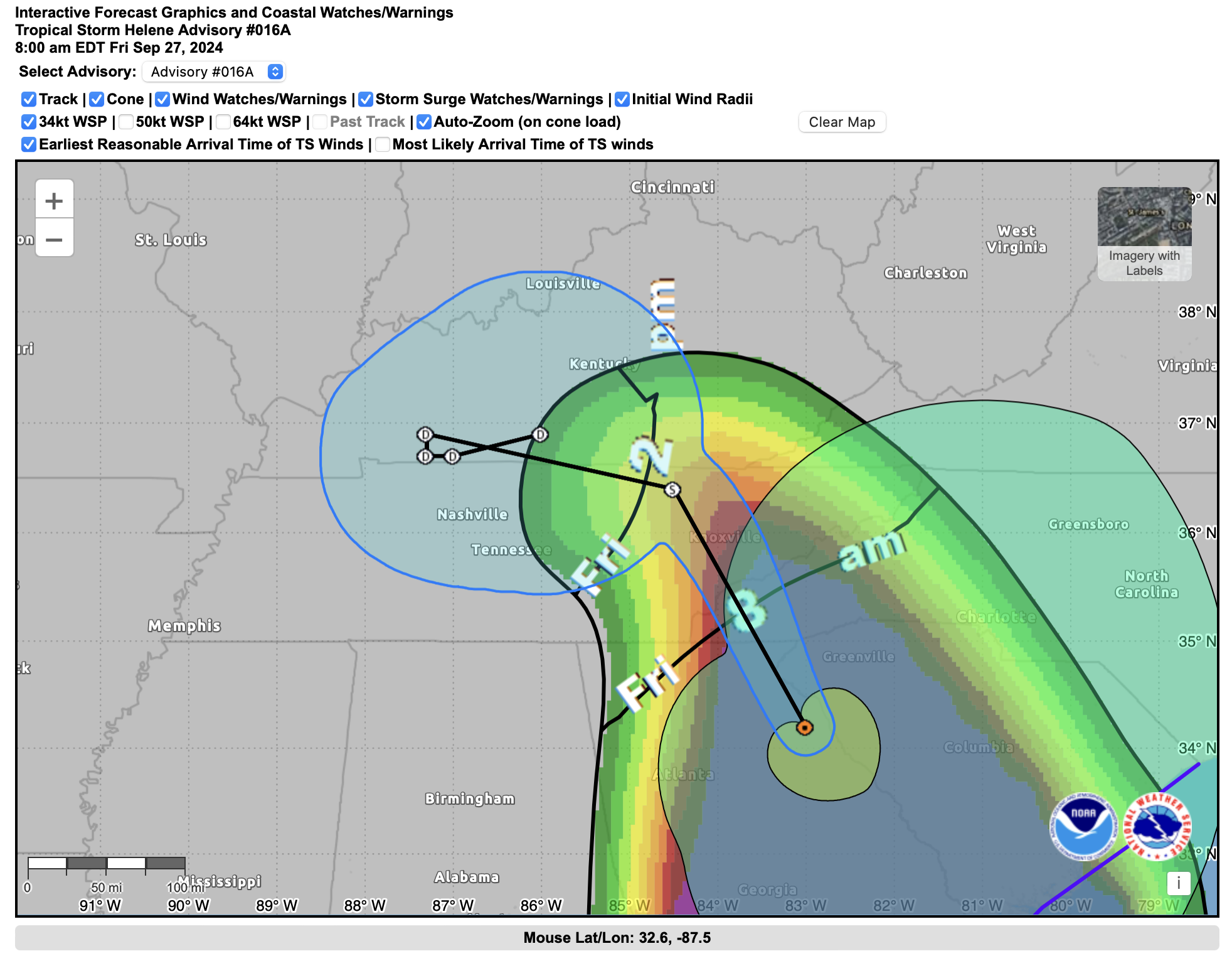
Update: 8:00 a.m. Sept. 27
-
David Hotz, Science and Operations Officer with the Morristown Weather Forecast Office of the National Weather Service, explains why the predicted track of Hurricane Helene has shifted westward from earlier projections: “There is a deep area of low pressure across west Tennessee. The circulation around this low will pull the remains of Helene back to the west into this area of low pressure. Something similar happened with Hurricane Sandy.”
 This graphic shows the very warm waters that fueled Hurricane Helene. NASA
Update: 4:30 a.m. Sept. 27
- Here’s a look at the plethora of current National Weather Service warnings in place across the Southern Appalachians:
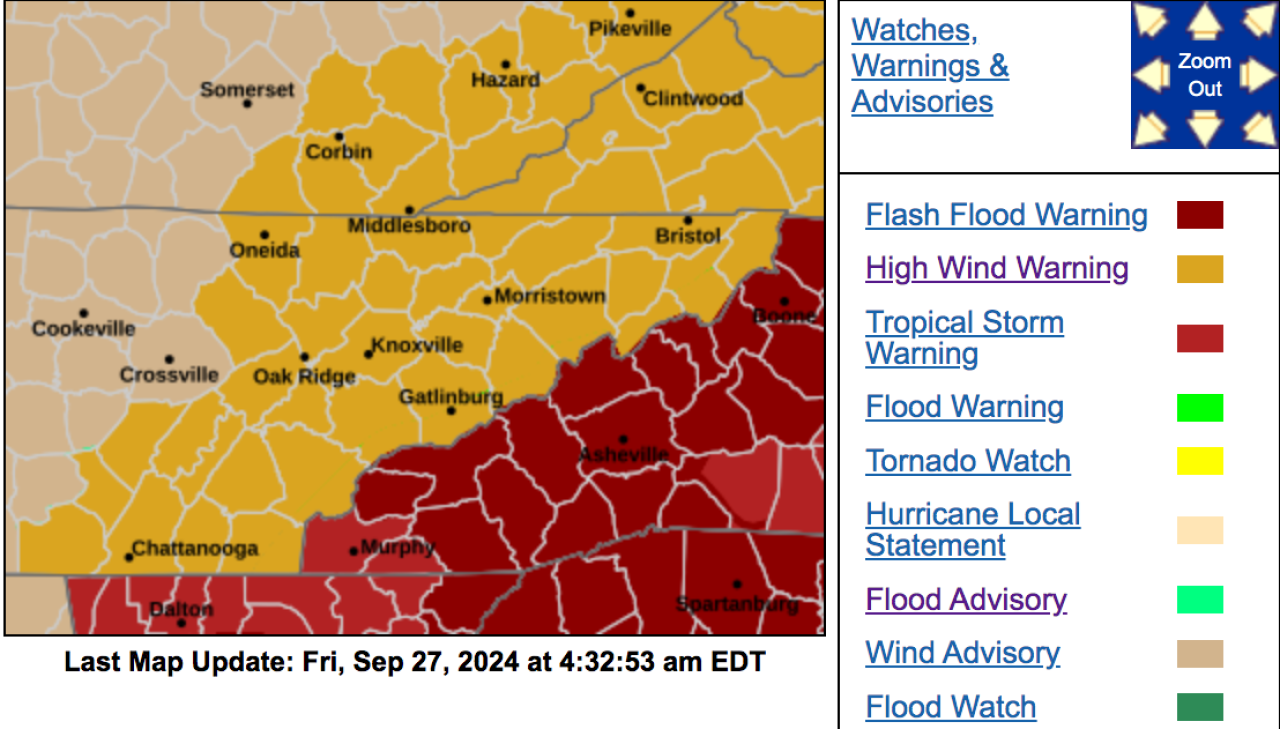
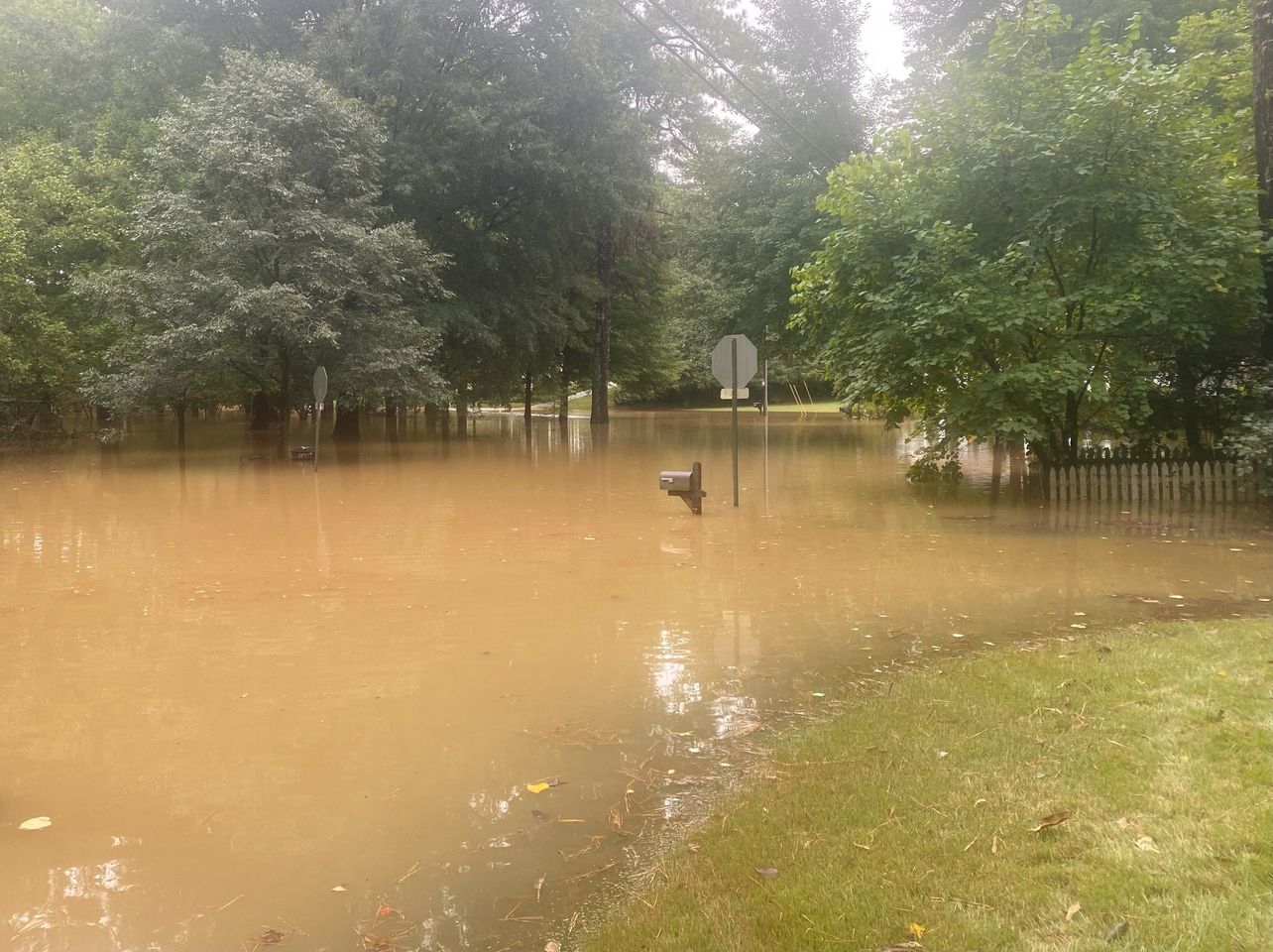
- The National Weather Service has declared a flash flood emergency for Haywood County in Western North Carolina. The warning extends through 10:15 a.m. Up to 20 inches of total rain are possible with the remnants of Helene and preceding rain events. The Weather Channel reports multiple water rescues are under way. Flash flood warnings are also in place in Graham and Swain counties.
Update: 3:30 a.m. Sept. 27
- At least 2 million customers are without power in Georgia, Florida and the Carolinas, according to PowerOutage.us.
-
Winds are beginning to pick up in the Knoxville area. The weather service warns of sustained winds in the 30-mph range with gusts of up to 60 mph. A high wind warning is in effect through 8 p.m. Power outages are likely, as fully-leafed trees topple in sodden soil.
- Multiple school districts are closed in the Knoxville area ahead of the expected arrival of the remnants of Helene.
- WNC Scanner Traffic is a social media site based in Macon County, N.C. It is currently crowd-sourcing and reporting on first-responder radio traffic and weather conditions, even in the wee hours.
- Check out this video of raging waters at Laurel Falls in the Great Smokies courtesy of Dana Soehn via social media.
Update: 2:30 a.m. Sept. 27
-
A flood warning is in effect for most of south and central East Tennessee; a flash-flood warning is in effect for much of the Knoxville area.
-
In addition to traditional point sources of weather data maintained by government agencies, such as airports, WeatherUnderground hosts a global network of weather sensors and data stations, some of which can probably be traced to be your neighborhood.
-
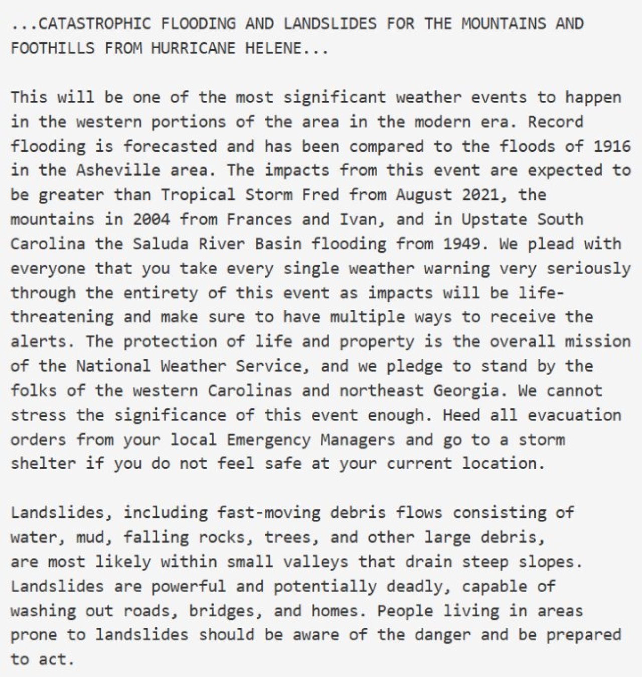
The National Weather Service in Greenville released this ominous and unusually personal message Thursday afternoon:
-
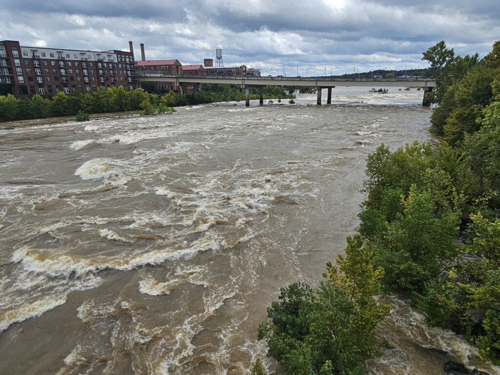
WLOS in Asheville reports widespread flooding, including in the city’s River Arts District along the French Broad River.
-
Per its X feed, Haywood County (N.C.) Emergency Services opened a shelter at the Armory in Clyde.
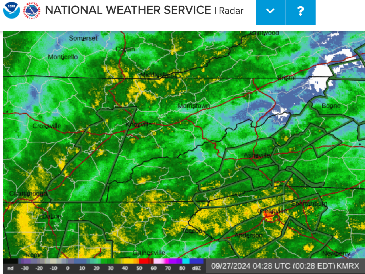
Update: 12:30 a.m. Sept. 27
- A steady stream of moderate to heavy rain is streaming from the southeast into the Southern Appalachians. A major factor in the high threat posed by the heavy rain is preceding days of rain that saw at least 2-4 inches fall in many areas, with locally very higher amounts
- The folks over at Ray’s Weather have been diving deep, and reliably, into the forecasts of Western North Carolina and the Asheville area for years. They foresee, like the National Weather Service, an historic rain event. It’s a business, but began in the backyard.
- Turley writes that the “French Broad flooding looks to go to record heights in several spots. The Swannanoa River at Biltmore is projected to go well over record flood stage.” Asheville journalist Jason Sandford, who runs the Ashevegas blog, said areas prone to flooding — such as Biltmore Village — had begun to flood even before the heavier rains began moving into the area.
- The Georgia Mountains and Southern Appalachia Facebook page cracked wise:

- The Atlanta Journal Constitution dropped its paywall as a public service during the storm, which entered Georgia as a category 2 hurricane.
- More than one million customers are without power in Florida, Georgia, and the Carolinas, according to U.S. Power Outage Map. The number only applies to individual accounts, so multiple people are often affected.
- In the northeast Atlanta neighborhood of Medlock Park, the South Fork of Peachtree Creek has already risen some 20 inches above the banks. Long-time residents are saying this is the worst they’ve seen in 20 years — and the really hard rain still hasn’t begun. They expect many homes in the area to flood tonight.