Smokies officials cited at least 8.72 inches of rain recorded July 12, but a National Weather Service official cautioned that estimation was based on radar data, and was more likely on the lines of 6-8 inches.
Still, that amount of rain, which was preceded by heavy rainfall in previous days and generated by at least three heavy thunderstorm bands in a three-hour timeframe over the Greenbrier and Porters Gap areas, was remarkable.
“We typically see those kind of rain amounts with a tropical storm,” said Anthony Cavallucci, a National Weather Service warning coordinator meteorologist based in Morristown.
He said a flash flood warning was issued by NWS at 11:16 p.m. July 12, which covered Southwest Cocke County and Southeast Sevier County, including Gatlinburg, Pittman Center and a large part of the national park.
The weather service was simultaneously monitoring an outbreak of severe weather across the region, including many storms that generated wind damage, he said. The state record for rainfall was set last year with at least 17 inches of rainfall within a day at Waverly; the subsequent flooding killed 20 people.
WATE in Knoxville ran interviews with people camping at Greenbrier who said they stacked picnic tables so they could lift their children out of the floodwaters. As many as 400 people were evacuated. Vehicles, campers, gear and personal possessions were washed away or severely damaged.
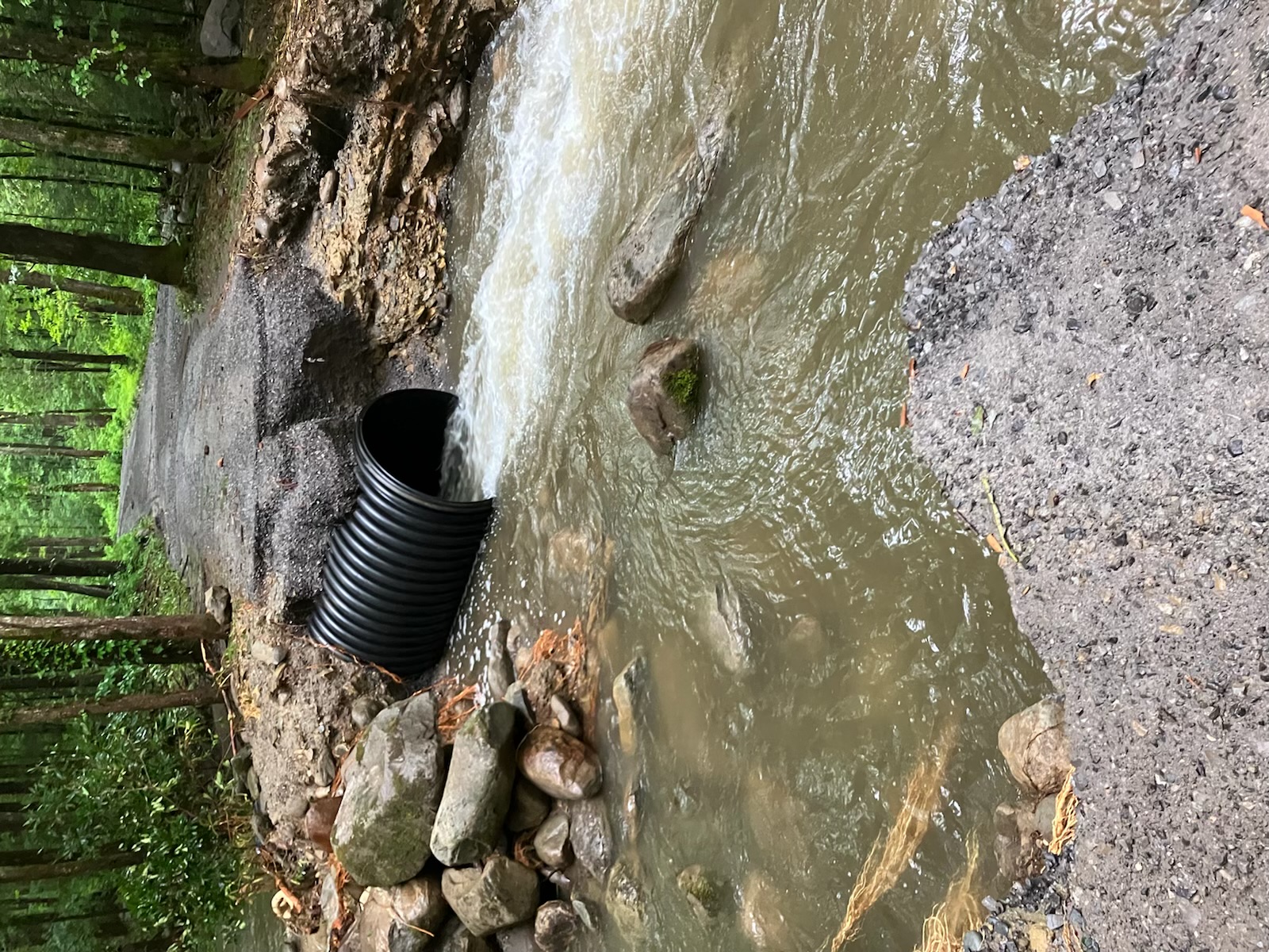
“Preliminary damage assessments include significant road washouts along the Porters Creek Road, culvert damage, and washed out footlogs on Ramsey Cascades Trail,” according to a release from the park service.
“The temporary closure includes all roads, Greenbrier Picnic Area, Greenbrier Picnic Pavilion, Ramsey Cascades Trail, Porters Creek Trail, and Backcountry Campsites 31, 32, and 33. Old Settlers, Brushy Mountain, and Grapeyard Ridge Trails will continue to be open, but hikers cannot access these trails from the Greenbrier area during the closure and should plan their routes carefully. Hikers should be prepared to turn around if they encounter high-water river crossings or damaged trail conditions along these routes.”
Social media reports suggested all footbridges were washed out at Ramsey Cascades.
As for the water consumption advisory warning from the city of Sevierville, which operates the county water-treatment facility, it is not yet known how long it may persist.
“We don’t know,” said Sevierville Public Information Officer Bob Stahlke. The city operates the water system, which serves the city as well as some eastern parts of Sevier County. Primary concerns involve the introduction of fecal contaminants into the water system.
“We are waiting for testing to be complete,” Stahlke said.
The vast majority of scientists believe climate change will reduce or intensify rain events in areas such as the Southern Appalachians. The weather service warned of the possibility of severe flooding after the Smokies wildfires in 2016, Cavallucci said, but those concerns didn’t immediately materialize. While the full scale of precipitation disruption is not yet known, ORNL scientists have concluded that areas such as the Southern Appalachians face an increased wildfire threat, which could enhance debris flows and damage during atypical rain events.
Is this recent flooding a result of climate change?
“We are really good at forecasting seven-day forecasts,” Cavallucci said, adding that longer-range forecasts “are not our forte.”